
Background
While drones have applications in the energy and utilities industry, other industries such as urban development, construction and infrastructure, supply chain, and logistics also benefit from their use.
Drones at construction sites are used to scan, record, and map locations; survey buildings or land; track machines; perform remote monitoring; secure construction sites; inspect buildings; and help to ensure worker safety. Drones are also used commercially as first-aid vehicles, as tools for investigation by police departments, in high-tech photography, and as recording devices for real estate properties, concerts, or sporting events.
In the energy and utilities sector, inspecting the growing numbers of towers, powerlines, and wind turbines is difficult and can be dangerous to personnel. This creates prime opportunities for drones to replace human inspection with computer vision-based inspection and diagnosis. However, if a drone meets with an accident while landing, it could damage assets and injure personnel.
Paved areas dedicated to drone landings are considered appropriate and must be visually confirmed prior to landing. This reference kit may assist you in developing a model to help identify the segments of paved areas available for landings.
Solution
In collaboration with Accenture*, Intel developed this drone navigation inspection AI reference kit. Paired with Intel® software, this kit may help customers to develop models to improve the performance of image processing, reduce training time and inferencing time, and scale the use of complex models by compressing models to run efficiently on edge devices. This reference kit includes:
- Training data
- An open source, trained model
- Libraries
- User guides
- Intel® AI software products
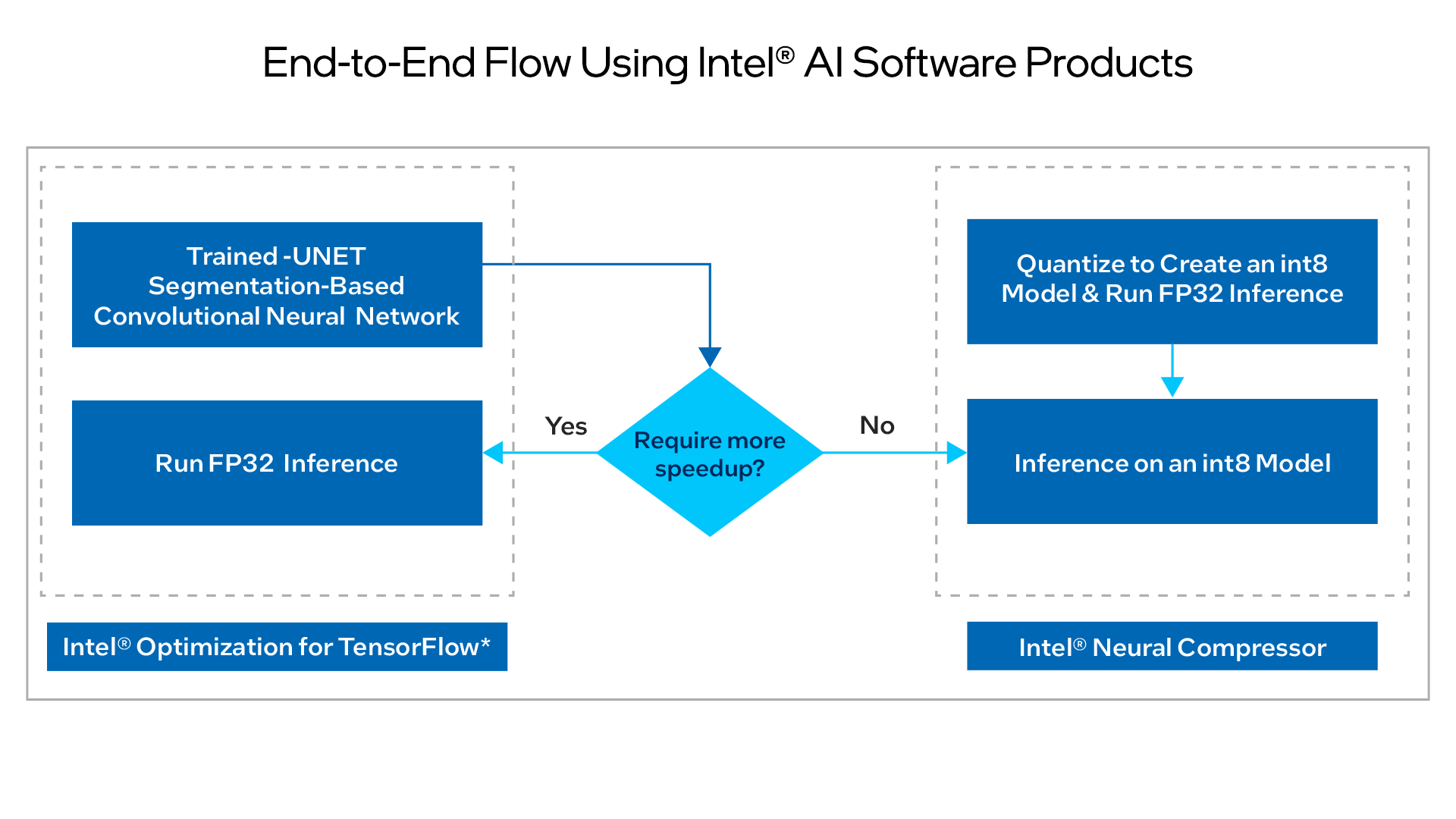
This reference kit uses Intel oneAPI to demonstrate one-way applications of a TensorFlow*-based AI model that works on drone technology. The AI models developed help to segment paved areas and increase the probability of a safe drone landing.
The process takes a drone camera image as input and passes it through a semantic segmentation model (VGG-UNET architecture) to recognize entities (such as a paved area, people, vehicles, or dogs). This is done while benchmarking the speed and accuracy of training and inference in both batch and real-time with Intel technology. To deploy this model on edge devices with less computing and memory resources, the model is quantized and compressed while achieving the same level of accuracy and efficient use of underlying computing resources.
At a Glance
- Industry: Energy and utilities
- Task: Segment the paved area and different objects (20 classes) around the drone path to land the drone on the paved area
- Dataset: Drone dataset of images and labels
- Type of Learning: Supervised learning for computer vision
- Models: Semantic segmentation model (VGG-UNET architecture) to classify images
- Output: Paved area segmentation
- Intel® AI Software Portfolio:
- AI Tools
- Intel® Optimization for TensorFlow* (Intel® oneAPI Deep Neural Network Library [oneDNN] optimizations on by default)
- Intel® Neural Compressor
Technology
Optimized with Intel oneAPI for Better Performance
Model optimization and compression is done using Intel Neural Compressor. This kit is implemented using stock TensorFlow* 2.8.0 and TensorFlow 2.9.0 with oneDNN optimization settings on by default.
Performance was tested on Microsoft Azure* Standard_D8_v5 using 3rd generation Intel® Xeon® processors to optimize the kit.
Benefits
The application of AI models for drone landings can be further optimized using the AI Kit, which improves the performance of compute-intensive image processing, reduces training time and inferencing time, and scales the use of complex models by compressing models to run efficiently on edge devices. Intel Optimization for TensorFlow, with the oneDNN library optimizations on by default, provides additional optimizations for an extra performance boost on Intel CPUs.